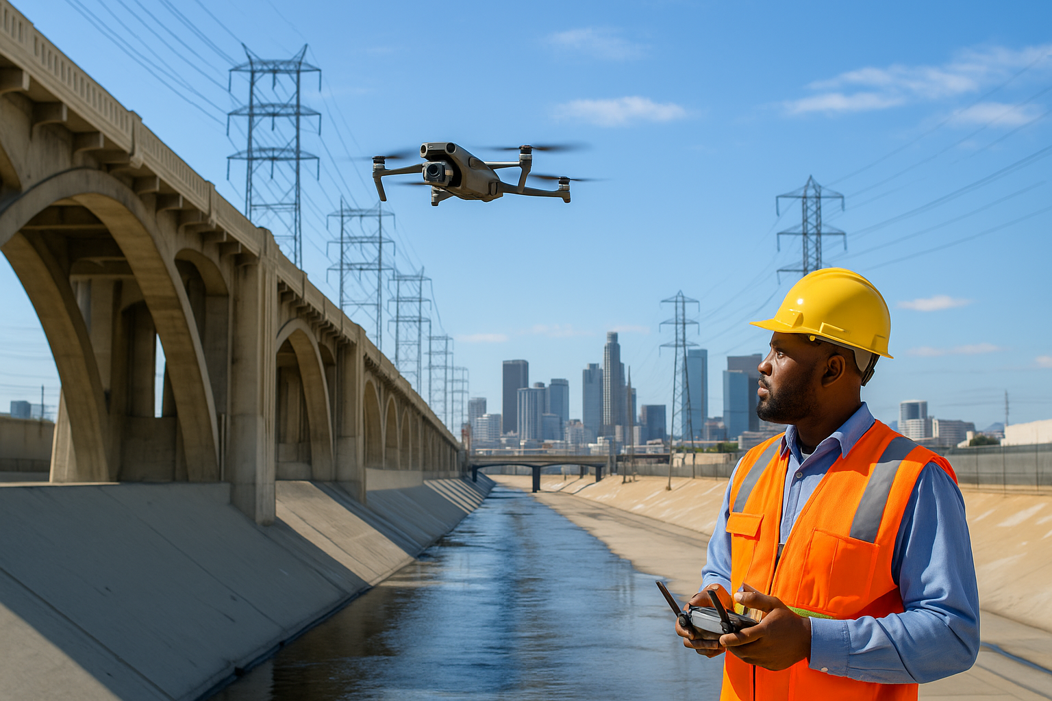
Aerial Videography & Photography for Construction
Why Choose Our Drone Construction Services in El Paso
01 Certified Pilots
Our team of FAA certified pilots ensures that all drone operations are conducted safely and in compliance with all regulations. Their expertise guarantees high-quality data collection and reliable service for your construction projects.
02 Safety
Safety is our top priority. Our drone services enhance construction site safety by providing real-time aerial views, identifying potential hazards, and strictly following safety protocols. This proactive approach minimizes risks and maintains a safe working environment. Our OSHA 30-Hour Certification sets us apart, ensuring the highest safety standards on every project.
03 Efficient Progress Tracking
Keep your construction projects on track with our efficient progress tracking services. Our drones capture detailed visual documentation, allowing you to monitor progress, identify issues early, and ensure timely project completion.
The Impact of Aerial Imagery on Construction Projects
Benefits of Aerial Photography in Construction
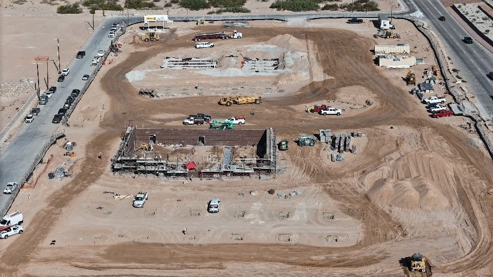
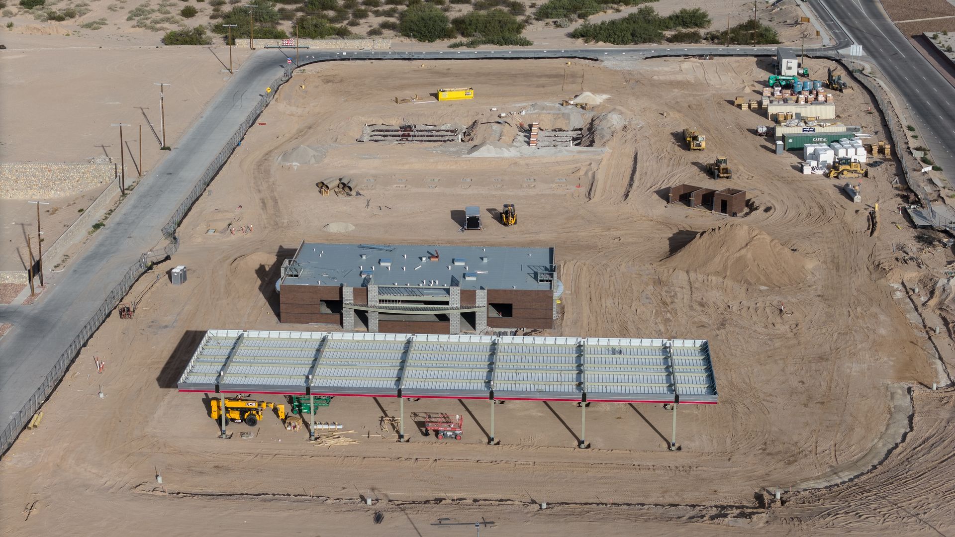
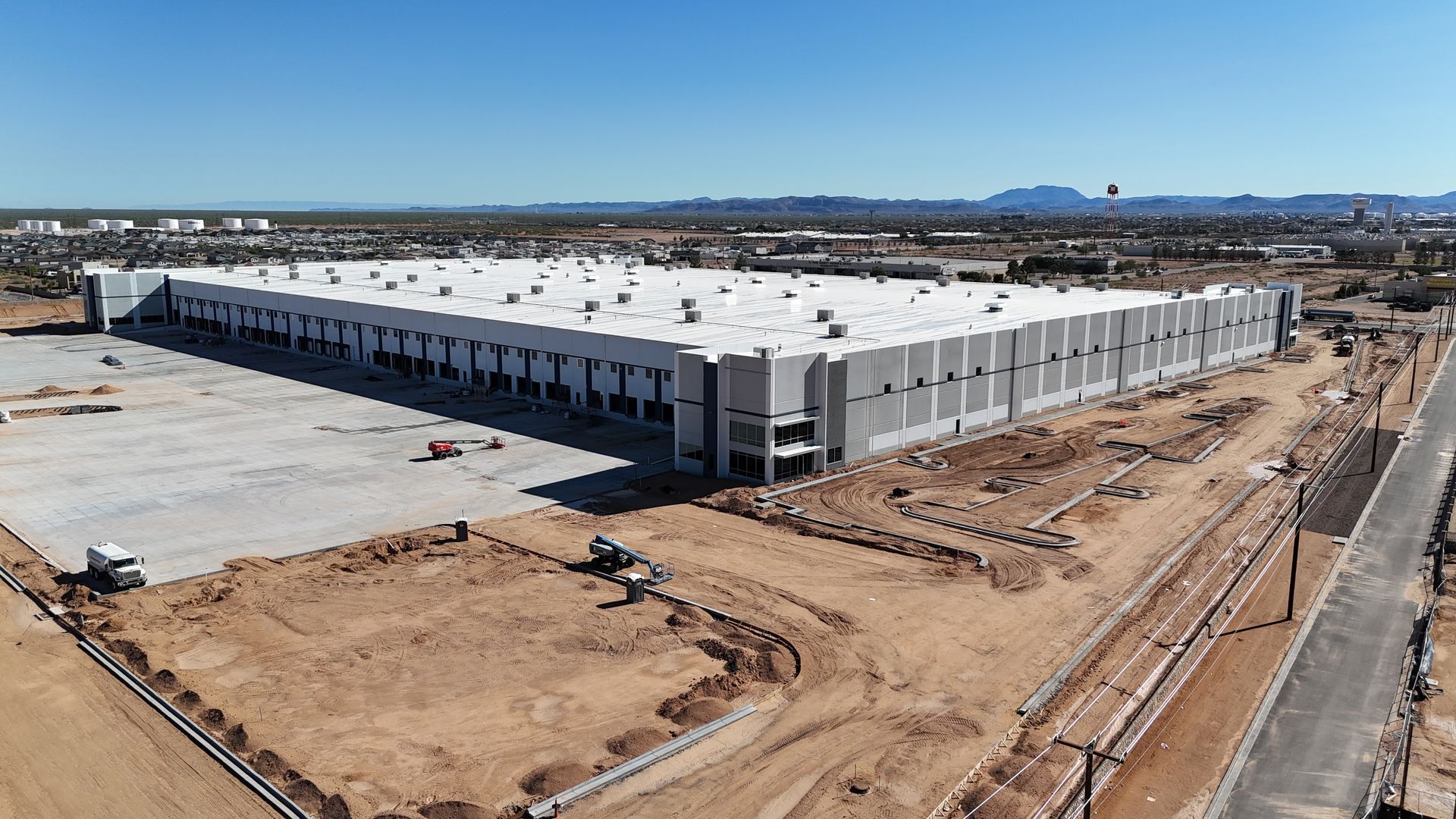
Aerial photography in El Paso construction offers numerous benefits, including improved site analysis, enhanced safety inspections, and efficient resource management. High-resolution images and videos enable construction managers to make informed decisions, identify potential issues early, and ensure compliance with regulatory standards. The ability to capture thorough site views also facilitates better communication among team members and stakeholders
OSHA 30-Hour Certification: Ensuring Safety
Safety is paramount in the construction industry, and at From Above Droneworks, our OSHA 30-Hour Certified team demonstrates our dedication to the highest safety standards on all projects. This certification equips our team with the knowledge to identify and mitigate potential hazards, ensuring a secure working environment for all stakeholders.
Benefits of Our OSHA 30-Hour Certification
Key Benefits:
- Enhanced Safety Protocols: Rigorous procedures for safe drone operations.
- Regulatory Compliance: Adherence to OSHA standards reduces the risk of violations.
- Expertise: Trained to handle complex safety challenges effectively.
- Precision and Accuracy: High-resolution aerial imagery and data for accurate site assessments.
- Efficiency and Speed: Quick data collection and processing to keep your project on schedule.
- Advanced Technology: Utilizing the latest drone technology for optimal results.


Request Professional Drone Services
A Free Quote
Fill out the form below to receive a fixed service quote within 1 business day
Centralized Aerial Videography for Construction
Simplify Project Monitoring with Aerial Data
Aerial videography transforms how construction companies plan and oversee projects. Drones capture detailed footage of each phase, improving monitoring and progress tracking. This centralized data keeps stakeholders informed and aids future projects, leading to better decision-making and outcomes.
"Video powered by DroneDeploy."
“Amazing service and a great experience overall.”
Jaime Aranda / El Paso, Texas
Site Mapping
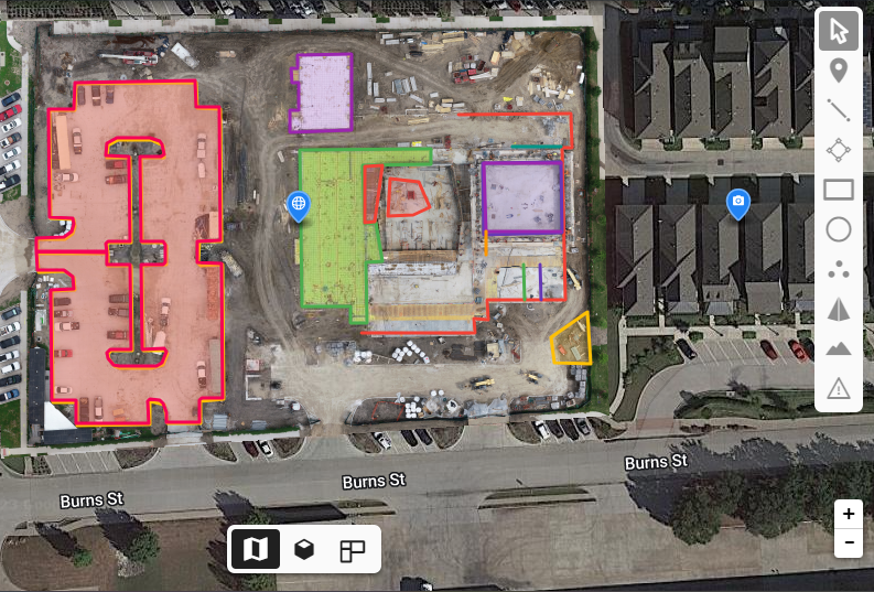
Site Survey
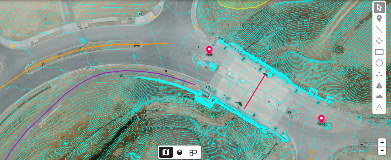
Inspection
Streamlining Construction Phases
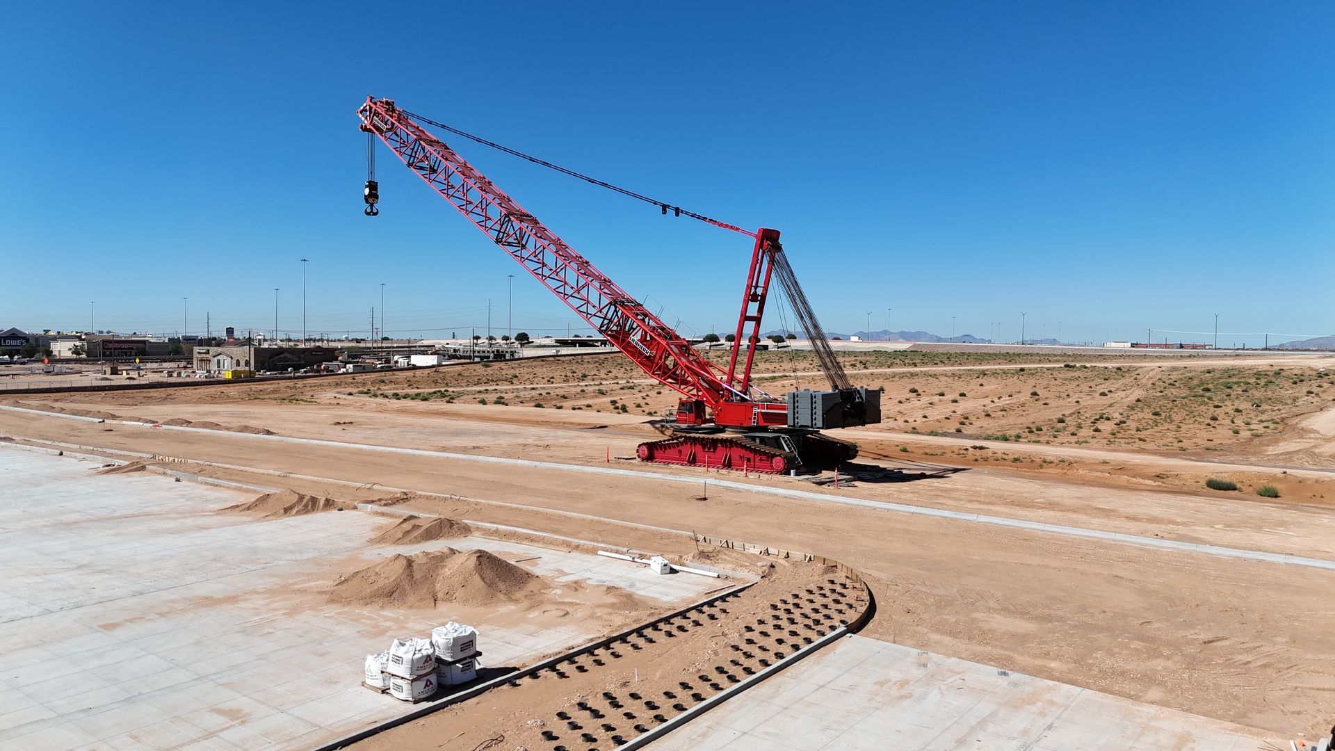
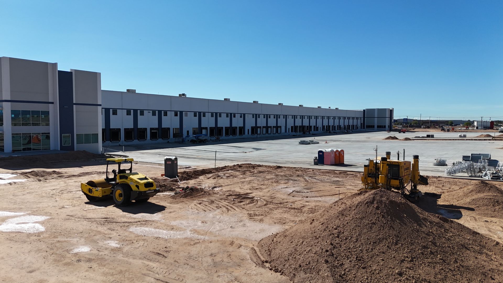
Drones hold significant value across the construction process. Aerial inspections yield extensive data crucial for planning, compliance, and monitoring in building design, engineering, and construction stages. They offer decision-makers a simple means to evaluate sites, track progress, inspect various structures, and address potential issues. Drones play a vital role in construction planning and management, serving throughout the entire lifecycle, from feasibility assessments and bidding to project completion and ongoing maintenance.
Efficient Project Documentation
In construction, drones help by gathering Building Information Modeling (BIM) data, allowing companies to spot and fix issues before they occur on-site. They also aid communication with subcontractors and clients. Drones provide useful insights into project progress, enhancing safety and logistics. They seamlessly integrate with BIM workflows, streamlining complex construction processes involving multiple skilled workers. Using drones allows for faster progress tracking, comparing plans with the actual structures.
Leveraging Drones in Asset Management
Drone imagery and video showcasing the final product significantly enhance customer satisfaction upon project completion. Additionally, this data serves a practical purpose in property management and maintenance, offering owners and managers a visual record of the building's as-built condition.
During construction, drones can fly over and around sites, providing near real-time visual progress reports for developers, stakeholders, and on-site personnel. This engaging documentation captures the project's ongoing status effectively. Moreover, updated visual materials can validate commitments to local authorities or planning agencies, such as parks, roads, green space layouts, or tree protection orders.
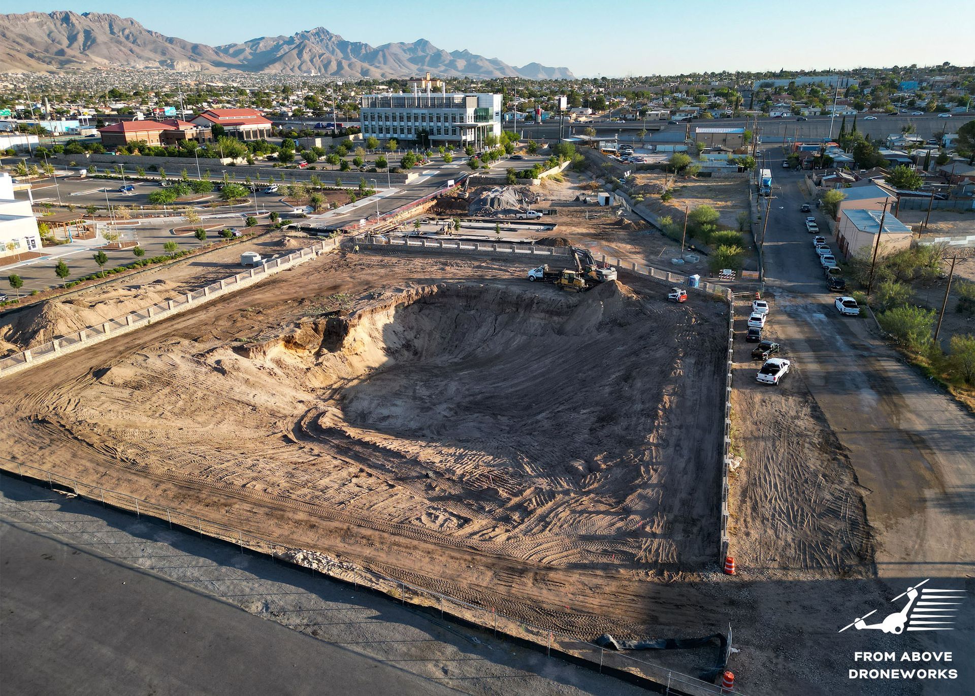
Before & After: Construction Progress
Drones document construction progress effectively. They capture before-and-after visuals, aiding in precise project monitoring. This technology offers valuable insights, streamlines data collection, and helps in decision-making for construction projects.